Page 898 - techequipmentscatalogue2016
P. 898
VIVAX
METROTECH
The vLocDM2 Receiver
The user interface of the vLocDM2 is custom designed for the location and defect mapping application
• The Locate Display
• The clear color display, provides both setup and information/data while at the same time providing
dynamic locate information .
• The arrows and directional compass bar enable quick, accurate pipe location and other useful data
such as continuous/depth measurement,
• GPS signal strength , Bluetooth connectivity, log number and distance from last stored reading are
also displayed.
• Real Time Data & Graph Display for Enhanced Productivity
Records stored together with GPS co-ordinates within the receiver. Real time graphs (plots) are
created for analysis. The red line indicated on the plot indicates the true position of the operator on the
graph . This feature is called the "walk back" feature and is used to return to a point of interrest.
• The A-frame
When using the receiver alone - the objective is to see at what point the signal (current) on the line
reduces. When using the A-frame the objective is to find an increase in ground potential (voltage)
where the voltage to ground increase due to poor coating . The vLocDM2 shows an application specific
screen - when the A-frame is plugged in the vLocDM2 display provides forward/back arrows, signal
strength and locate data - all the information needed to stay targeted on the pipe and guided to the
fault.
Accessories
Standard Accessories
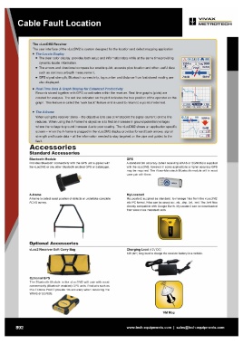
Bluetooth Module GPS
Provides Bluetooth connectivity with the GPS unit supplied with A standard 3m accuracy (when receiving WAAS or EGNOS) is supplied
the vLocDM2 or any other Bluetooth enabled GPS or datalogger. with the vLocDM2 , however in some applications a higher accuracy GPS
may be required . The Vivax-Metrotech Bluetooth module will in most
case pair with them .
A-frame MyLocator2
A-frame to detect exact position of defects or undertake complete MyLocator2 supplied as standard , to manage files from the vLocDM2
ACVG survey. into PC format. Files can be saved as: .xls, .shp , .txt, .kml. The .km l files
directly compatible with Google Earth MyLocator2 can be downloaded
from www.vivax-metrotech.com
Optional Accessories Charging Lead (12V DC)
12ft (4m) long lead to charge the receiver battery in a vehicle.
vLoc2 Receiver Soft Carry Bag
Optional GPS
The Bluetooth Module in the vLocDM2 will pair with most
commercially (Bluetooth enabled) GPS units. Products such as
this Trimble ProXT provide 1m accuracy when receiving the
WAAS or EGNOS .
892 VM Map
www.tech-equipments.comlsales@tech-equipments.com
METROTECH
The vLocDM2 Receiver
The user interface of the vLocDM2 is custom designed for the location and defect mapping application
• The Locate Display
• The clear color display, provides both setup and information/data while at the same time providing
dynamic locate information .
• The arrows and directional compass bar enable quick, accurate pipe location and other useful data
such as continuous/depth measurement,
• GPS signal strength , Bluetooth connectivity, log number and distance from last stored reading are
also displayed.
• Real Time Data & Graph Display for Enhanced Productivity
Records stored together with GPS co-ordinates within the receiver. Real time graphs (plots) are
created for analysis. The red line indicated on the plot indicates the true position of the operator on the
graph . This feature is called the "walk back" feature and is used to return to a point of interrest.
• The A-frame
When using the receiver alone - the objective is to see at what point the signal (current) on the line
reduces. When using the A-frame the objective is to find an increase in ground potential (voltage)
where the voltage to ground increase due to poor coating . The vLocDM2 shows an application specific
screen - when the A-frame is plugged in the vLocDM2 display provides forward/back arrows, signal
strength and locate data - all the information needed to stay targeted on the pipe and guided to the
fault.
Accessories
Standard Accessories
Bluetooth Module GPS
Provides Bluetooth connectivity with the GPS unit supplied with A standard 3m accuracy (when receiving WAAS or EGNOS) is supplied
the vLocDM2 or any other Bluetooth enabled GPS or datalogger. with the vLocDM2 , however in some applications a higher accuracy GPS
may be required . The Vivax-Metrotech Bluetooth module will in most
case pair with them .
A-frame MyLocator2
A-frame to detect exact position of defects or undertake complete MyLocator2 supplied as standard , to manage files from the vLocDM2
ACVG survey. into PC format. Files can be saved as: .xls, .shp , .txt, .kml. The .km l files
directly compatible with Google Earth MyLocator2 can be downloaded
from www.vivax-metrotech.com
Optional Accessories Charging Lead (12V DC)
12ft (4m) long lead to charge the receiver battery in a vehicle.
vLoc2 Receiver Soft Carry Bag
Optional GPS
The Bluetooth Module in the vLocDM2 will pair with most
commercially (Bluetooth enabled) GPS units. Products such as
this Trimble ProXT provide 1m accuracy when receiving the
WAAS or EGNOS .
892 VM Map
www.tech-equipments.comlsales@tech-equipments.com